Every feature, organized by what you're trying to do.
Grouped by product area — survey design & collection, analysis, reporting & communication, collaboration & integrations, and compliance. For the step-by-step project narrative, see the Product page
Designing and Implementing Community Surveys
Build the questionnaire and collect responses — spatial and standard question types, translation, accessibility, and gamified formats, all in one builder.
 Powered by AI
Build your survey from scratch or with AI
Go from an idea to a ready draft in minutes, then refine it in plain language.
Read more ↓
AIStart from an AI-generated draft: describe the survey you want, or paste in your draft questions.
AIRefine your survey with "Edit with AI": describe a change in plain language, such as adding questions, rewriting text or changing answer options, and undo any change.
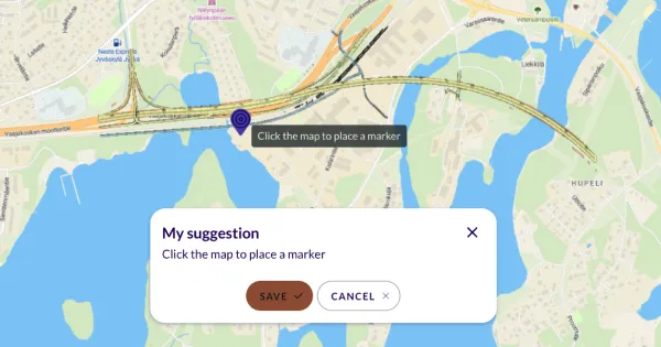
Map-based survey questions
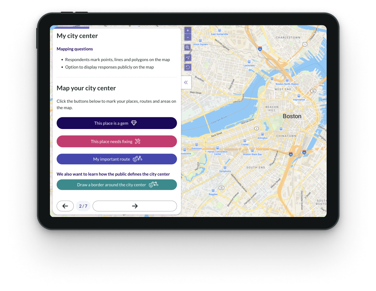
Choose from 6+ mapping question types, such as points, lines, and polygons — on a live map, or on an uploaded image (site plan, floor plan, rendering) used as the base map.
Read more ↓
Let respondents leave comments on the map by placing pins, or by drawing routes or areas.
Ask follow-up questions on what they draw (e.g. ‘What should we change here’)
Define the geographic boundaries for responses with masking layers or let respondents select from predefined map features (points, lines, areas, or grids) instead of drawing freehand.
Add clickable map pop-ups to present information and ask questions about select locations
Standard survey capabilities
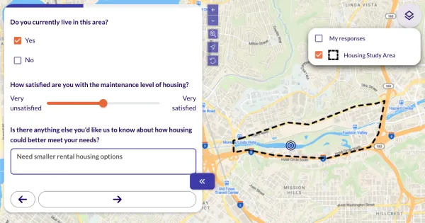
Choose from 9 standard question types — multiple choice, checkboxes, open text, matrix, slider, ranking and number entry — with skip logic and branching to personalize the path through the survey.
Read more ↓
Include images and videos — or ask respondents to upload their own
Combine standard questions with mapping questions for a richer data set
Ask respondents to choose between images or visualizations by incorporating them into multiple-choice/ranking questions
 Powered by AI
Multilingual capabilities
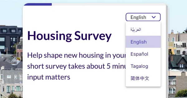
Translate questionnaires into any number of languages while keeping all responses in one place.
Read more ↓
60+ languages supported, including non-Latin scripts like Arabic, Chinese and Cyrillic
Automatically generates language specific URLs you can use in advertising.
AIAI translation can be instructed with prompts for tone or dialect, and it adapts multiple-choice options grammatically to the question. Review and edit before you publish.

Richly interactive maps
Add clickable pop-up map elements and follow-up questions tied to specific locations for richer, place-based feedback.
Read more ↓
Let respondents select from predefined map geometries — such as parks, buildings, or bus stops — for precise feedback.
Jump respondents to different map locations based on their answers, like a zip code.
Gamified & participatory budgeting
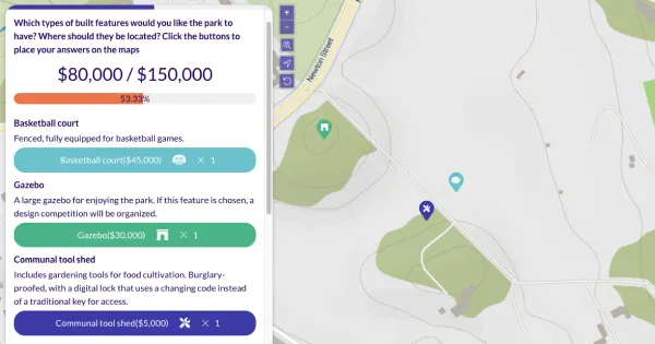
Identify top priorities by asking respondents to make choices within a limited budget.
Read more ↓
Use "geobudgeting" (geolocated participatory budgeting) to let respondents place favorite ideas on the map within a limited budget.
Run multi-phase budgeting projects with a custom landing page, idea collection/editing, and voting.
Analysis · the differentiator
Analyzing Results
See patterns the moment data comes in: dashboards, maps, spatial analysis, and AI-assisted analysis and reporting, without exporting to another tool.

Results dashboard
Watch charts and maps of community input update in real-time.
Read more ↓
Track participation and survey completion rates.
Customize dashboards with your favorite charts and maps. Return to them anytime or share with your team, clients, and stakeholders.

Visual mapping results
Generate heatmaps, dot maps, and maps of community-identified routes or areas.
Read more ↓
Fully-customize the data visibility, colors, and graphic look of your finished maps.
Spatial analysis
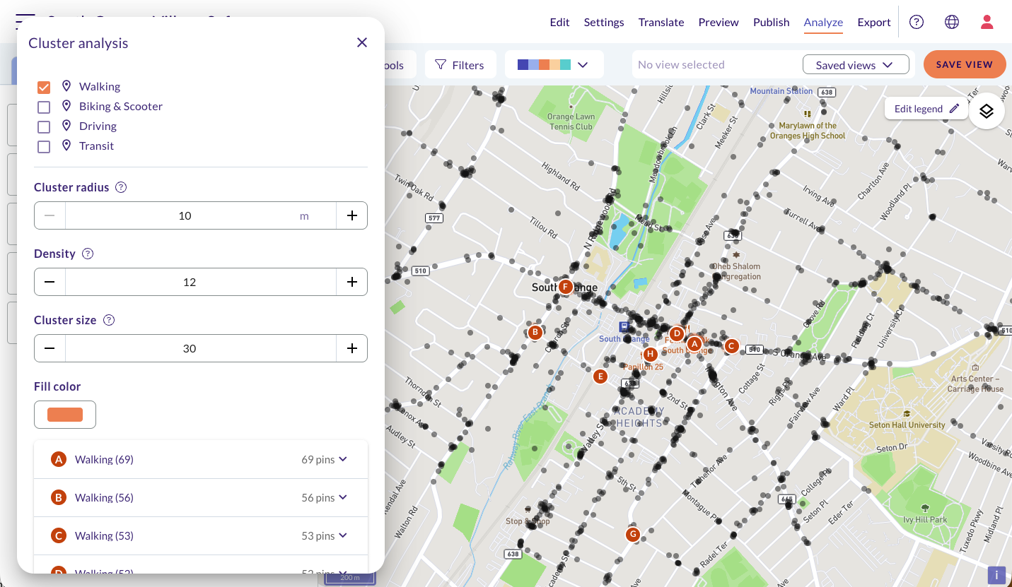
Find hotspots, popular routes and differences between areas in thousands of map markings, with no GIS skills needed.
Read more ↓
Cluster analysis shows where map points concentrate. Corridor analysis shows the routes many people drew along.
For each hotspot or route, see who the respondents were and what they said, compared with everyone else.
Compare areas: draw a boundary or use a map layer, such as district borders, and every chart updates to show only the respondents linked to that area.
Save any result as a view to explore its charts and comments.

Filter and cross-tabulate
Filter and cross-tabulate results by demographics, zip code, travel mode, area and more, to identify gaps and trends.
Read more ↓
Analyze spatial and nonspatial results together in a rich, comprehensive dataset.
Tag, color-code, categorize, and organize your data however you need.
 Powered by AI
AI-powered analysis
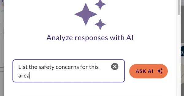
Make sense of hundreds of comments quickly. Ask questions, find themes and check the tone, all inside the analysis tool.
Read more ↓
AIAsk questions about your data in plain language, such as “Summarize the main concerns about this area”. Combine it with filters to focus on one group or place.
AITag open responses: AI finds the 5–10 most common themes and tags every comment. You can edit the tags, and they show up in your Excel export.
AISentiment analysis shows the share of positive, neutral and negative comments at a glance.
Your data is processed in its own region (EU data stays in the EU), is not retained, and is never used to train models.
 Powered by AI
Export for further analysis
Download results as Excel, Word, GeoJSON, shapefile or text. Send map data to ArcGIS Online or QGIS, or take an AI-ready text export to your own AI assistant.
Read more ↓
Download the original raw dataset, as well as analysis views, filters, and tags you made in Maptionnaire.
AIDownload results in an AI-friendly format that includes the context an AI tool needs to read your data correctly.
Reporting & communication
Reporting and Two-Way Communication
Report the analysis to stakeholders and keep the public informed — project pages, shareable dashboards, and public discussion, live throughout the project.
 Powered by AI
AI-written results report
Turn your results into a complete report in a couple of minutes, with narrative, charts and maps included.
Read more ↓
AIThe AI writes a narrative from your open answers and adds the charts and map hotspot analysis from your results. It covers every question type, not just open text.
Every section can be edited, reordered or removed, and you can style the report to match your brand.
Download it as Word, PDF or PowerPoint.
With a Communicate or higher subscription, turn it into a public Project Page (a simple web page about your project), then edit it and publish when you’re ready.
AIThe narrative is built from themes and how often each was mentioned, so every point is backed by numbers.
 Powered by AI
Project Page Builder
Create public-facing project pages and engagement hubs with our drag-and-drop webpage builder (CMS) — no coding needed.
Read more ↓
Embed interactive maps, surveys, community discussions, and project timelines directly on the page.
Customize the layout, branding, colors, and more. White-labelling also available.
AITurn an AI-written results report into an editable project page

Multilingual pages
Create translated versions of your pages in any language. Embedded surveys and sub-pages are automatically displayed in the visitor's chosen language.
Sharable results dashboard
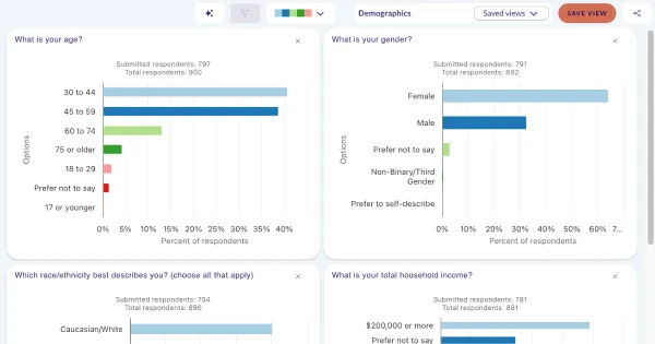
Share tailored views of real-time engagement results with your team, clients, or community.
 Powered by AI
Public responses
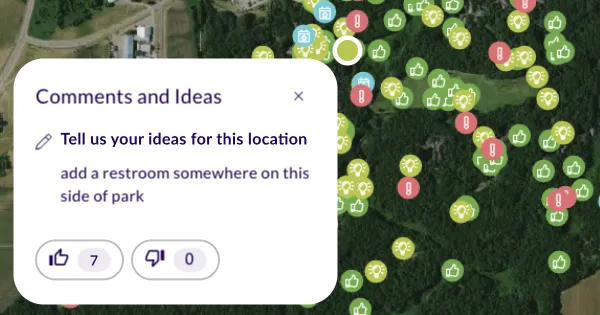
Enable respondents to view and react to each other's map comments, for greater transparency and richer engagement.
Read more ↓
AIModerate public comments by hand or with automated AI-assisted flagging.
Collaboration & integrations
Collaboration, integrations, and branding
Keep your team, your brand, and your existing GIS stack connected to the platform.
Templates & reusable elements
Create reusable templates for questions, surveys, and pages to maintain consistency and save time.
Read more ↓
Save color palettes and brand assets for on-branded visuals.
ArcGIS & other integrations
Use ArcGIS layers and styles in your surveys, and stream engagement results directly back to ArcGIS Online.
Read more ↓
Bring your own Mapbox maps and styles into questionnaires.
Connect Maptionnaire to other software via secure API integration.
Team workspace & access control
Invite unlimited team members to a secure, shared workspace — no shared logins needed.
Read more ↓
Manage and supervise team activity with role-based access control.
Download an audit report of all team activity in your workspace.
Compliance & support
Compliance and support
Everything IT, procurement, and legal will ask about — accessibility, privacy, security, ISO/IEC 27001:2022 certification, and support.
Onboarding & support
Every subscription includes an onboarding session, plus additional training options.
Read more ↓
Get responsive technical support via email or video call, with replies within 2 business days.
Accessibility
Maptionnaire is fully compliant with WCAG 2.1/2.2 AA and the Americans with Disabilities Act.
Read more ↓
Browser-based and mobile-friendly, with no download or registration needed to participate.
Respondents can save and resume their survey later.
Map questions work with screen readers and keyboards, so respondents can answer without a mouse or touchscreen.
Privacy and security
Maptionnaire is fully GDPR-compliant and ISO/IEC 27001:2022 certified.
Read more ↓
We offer two-factor authentication (2FA) for your team's login, plus single sign-on: Microsoft OpenID for internal team accounts, and Google or Facebook for respondents.
Data security & hosting
Data is encrypted at rest and in transit, with regular encrypted backups.
Read more ↓
Hosted on secure cloud infrastructure (AWS), primarily in Ireland (EU region), with a separate US hosting region for US-based clients.
AI features that use response data run on Claude, hosted on Amazon Bedrock in the same AWS region as your data. EU data stays in the EU and US data stays in the US.
Data and projects are retained for 90 days after subscription expiry.
AI across your workflow, optional every time.
From the first survey draft to the final report, AI takes on the slow parts. Every AI feature is optional, so you decide when to use it.
Build your survey from scratch or with AI
Go from an idea to a ready draft in minutes, then refine it in plain language.
Read more ↓
Describe the survey you want, or paste in your draft questions, and AI writes a draft questionnaire you can edit and publish.
Use Edit with AI in the editor to describe a change in plain language, such as adding questions, rewriting text or changing answer options. You can undo any change.
Moderate & translate
Reach respondents in their own language and keep public map comments safe.
Read more ↓
Pick the languages and let AI translate the whole questionnaire. Guide it with prompts for tone or dialect, and it adapts multiple-choice options grammatically to the question.
Check and edit the translation before you publish, since AI can miss the context of a question.
When respondents can see each other’s map comments, AI flags potentially inappropriate ones for you to review. Turn it on in the survey’s Settings, under Publication, or moderate by hand.
Analyze
Make sense of hundreds of comments quickly. Ask questions, find themes and check the tone.
Read more ↓
Ask questions about your data in plain language, such as “Summarize the main concerns about this area”. Combine it with filters to focus on one group or place.
AI finds the 5–10 most common themes in open answers and tags every comment. You can edit the tags.
Sentiment analysis shows the share of positive, neutral and negative comments at a glance.
Report
Turn your results into a complete report in a couple of minutes, with narrative, charts and maps included.
Read more ↓
AI writes a narrative from your open answers and adds the charts and map hotspot analysis from your results.
Edit, reorder or remove any section, then download it as Word, PDF or PowerPoint.
With a Communicate or higher subscription, turn it into a public project page, then edit it and publish when you’re ready.