
From the beginning, we knew this plan had to be owned by the community

That's Beth Poovey, PLA, ASLA, Principal at LandDesign, telling about the Downtown and River District Plan for the small but vibrant town of North Wilkesboro (North Carolina, USA).
For LandDesign—a multidisciplinary planning and landscape architecture firm dedicated to creating places that matter—community engagement is the foundation of any successful project. When tasked with this project, the core challenge was clear: co-create a plan that would resonate with officials, funders, and residents alike. Something widely-loved and ready for investment.
However, similar projects in the past struggled with engaging the community broadly and efficiently. Only twenty-or-so community members might show up for a workshop. It could take ages to process responses. The planning team might catch some of the narrative, but lack proper data to back it up.
The solution? Gathering broad, inclusive, and rich community input with the Maptionnaire Community Engagement Platform.
Using the North Wilkesboro Downtown and River District Plan as a case study, this article unpacks the community engagement challenges that LandDesign encountered and how they overcame them. We'll also include a close look at one of the Maptionnaire-powered surveys they created for that community.
Quick facts:
- 4400 residents in North Wilkesboro
- 2 Maptionnaire surveys + multiple in-person activities
- 1900 people participated online
- 200 people participated in-person
- Nearly 10x more participation online
- Countless hours saved from transcribing sticky notes
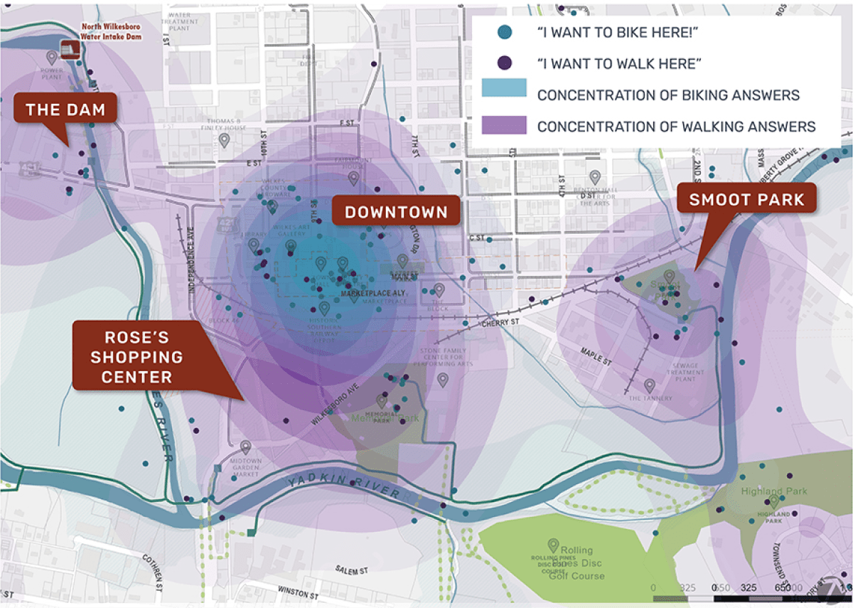
An Online Alternative to Physical Sticky-dot Maps
- Challenge: Efficiency. How to avoid late nights spent tediously transcribing stickers and hand-written comments?
- Solution: An online map-based questionnaire that collects digital comments and map annotations—digitized automatically by Maptionnaire, not your summer intern.
Remember the ‘sticky dot’ days of engagement? Like many others, Beth used to put up a big map at a public meeting, hand out colored stickers, and ask people to vote on priorities. "By the end of the night, the map looked colorful, but then… someone on our staff had to stay late transcribing dots into a spreadsheet."

Vandalizing a big map is fun and interactive, sure, but it takes a lot of resources to process the small number of not-so-detailed responses. These days, Beth and her team at LandDesign do things a bit differently.
The tools may have changed, yet the essence of good engagement hasn’t. It’s still about connecting people to place, listening deeply, and building trust. Maptionnaire just helps us do it smarter, broader, and more inclusively.
Beth Poovey, PLA, ASLA, Principal at LandDesign
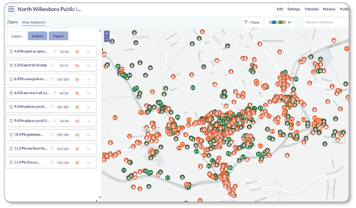
For the North Wilkesboro project, they simply uploaded their project map and plans into the Maptionnaire platform, layered them with interactive questions, and got digitized comments and rich data from hundreds of respondents.
Now let's talk about that data.
How They Gathered Community Data and Stories
- Challenge: Data quality. How to collect rigorous data and a meaningful narrative from the broader community
- Solution: The Maptionnaire platform gathers both qualitative and quantitative community insight—a huge variety and volume.
The ability to gather both quantitative and qualitative input has marked a significant shift in the field of community engagement. Quantitative data can be GIS data, survey responses, numbers that you can analyze, or points on a map. Qualitative data could be stories, comments, dreams, and frustrations that give soul to the data.
"The magic happens when you combine the two. The numbers show what the community values; the stories show why it matters," tells Beth.
The first questionnaire for the North Wilkesboro Downtown and River District Plan does exactly this, by asking the community for data, comments, visions, and map-markings that altogether build a meaningful foundation for planning.
Questions asked in the community engagement survey
Quantitative questions
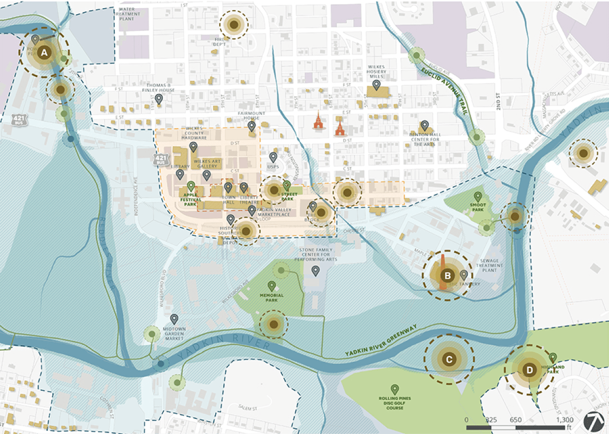
- Location-based (map markings)
- Favorite parks and trails
- Suggested parks and trails
- Suggested walking and biking destinations
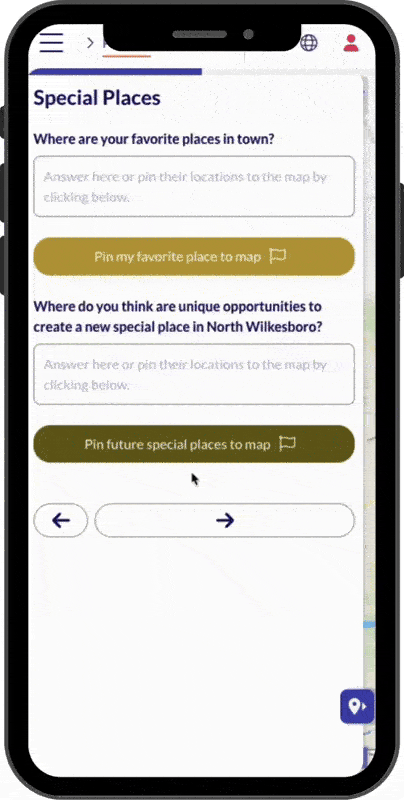
- Favorite special places in town
- Suggested special places
- Non-locational
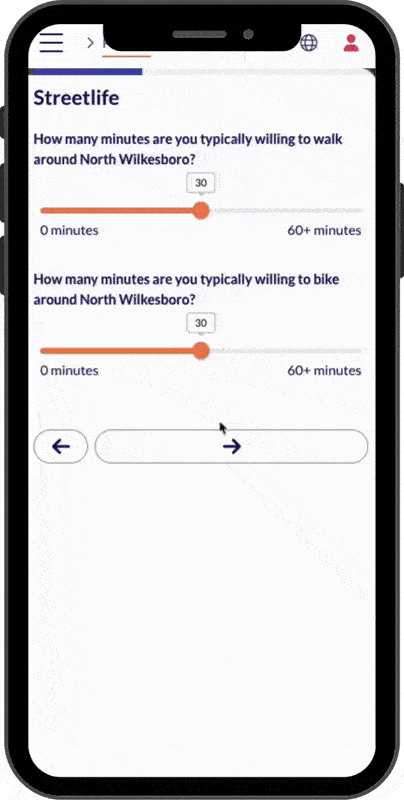
- Time spent walking or biking
- Demographic data
Qualitative questions
- Reasons for not biking or walking
- Reasons why a place feels special
- Reasons for suggesting a park, trail, destination, or special place
- What's unique or memorable about the town
- Vision for the future of the town
An online platform for community engagement
While LandDesign gathered a valuable mix qualitative and quantitative data using Maptionnaire alone, they also used in-person activities to diversify and deepen their data.
Let's dive into that hybrid approach.
Broader Reach with Hybrid Community Engagement
- Challenge: Broad, diverse participation. Alone, neither online nor in-person engagement will capture the full diversity of the community.
- Solution: Hybrid engagement leverages the strengths of each method for the broadest engagement possible.
For many of LandDesign's projects, they prefer a hybrid engagement model—a mix of in-person and online.
In-person engagement methods
In-person engagement focuses on being tactile, interactive, and fun. Some people just need that face-to-face. That moment of trust.
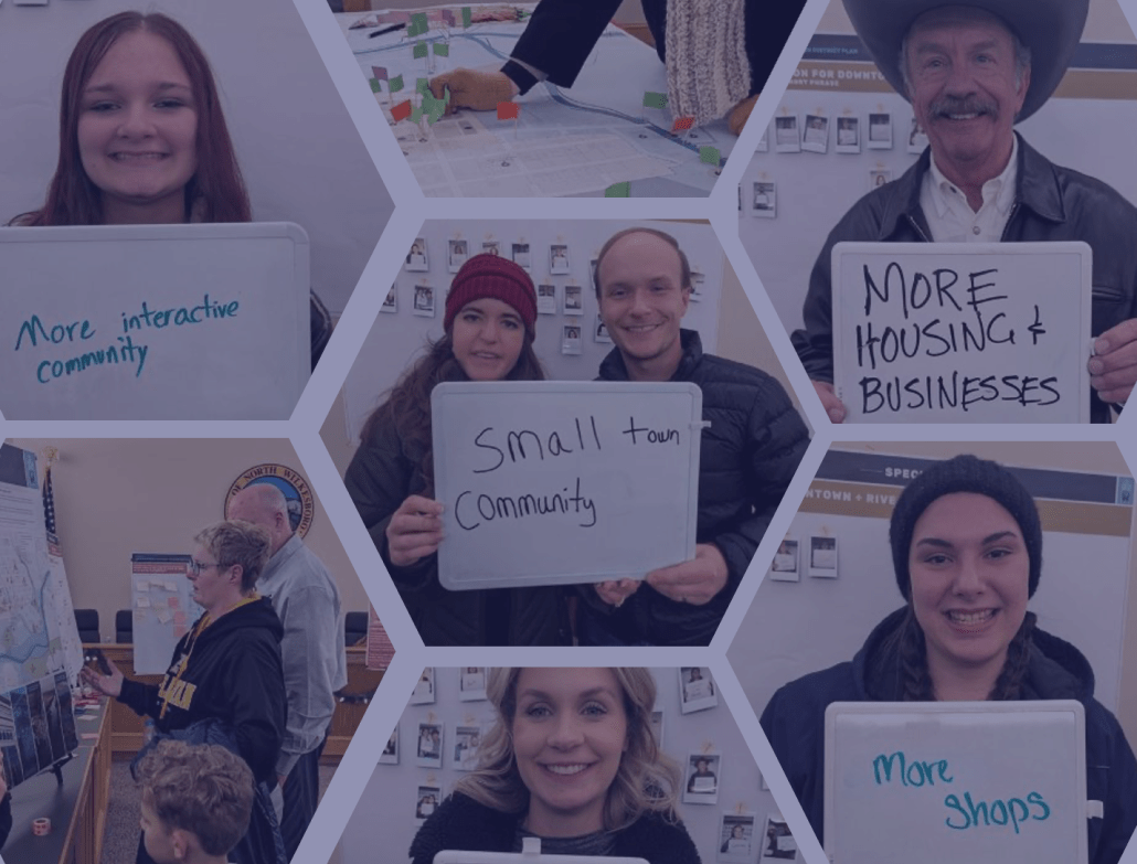
For the North Wilkesboro project, LandDesign visited local businesses and community events to hear development ideas and collect map markings. Maybe a few sticky notes are still ok. They also used in-person engagement as an opportunity to promote their online survey for people who weren't able to participate in the moment.
Online engagement methods
Online engagement is all about flexibility and accessibility for the participants. Online engagement not only gets that rich, high-quality digital data that we discussed earlier, but in volumes that matter.
In one week, we can reach hundreds of voices—not just the 25 people who had time to come on a Tuesday night
Beth Poovey, PLA, ASLA, Principal at LandDesign
For the North Wilkesboro project, over 90% of the 2100 participants opted to answer the online Maptionnaire survey. "In one week, we can reach hundreds of voices—not just the 25 people who had time to come on a Tuesday night," Beth tells. That's largely because people can open up a Maptionnaire survey anytime, anywhere on their phones or other devices. Even on a Tuesday night.
The Outcome: Community-Driven Plans
What would you do with 2100 responses? Celebrate? Panic? It's not uncommon to hear that planners or city officials are intimidated by the "noise" or chaos of so many responses. But if the process is clear and purposeful, it's not noise. It's insight.
... It's a shop owner who remembers when Main Street was thriving.
... It's a teenager who dreams of biking safely to the river.
It's real stories, linked to powerful data, that LandDesign captured, understood, and integrated into a deeply community-driven plan.


.jpeg)
.webp)

.webp)


.webp)
.png)


