People would say, "I like it," or "looks great," or "I don't like it," but we didn't know why, or we didn't know which parts they liked or didn't like.
Gabrielle Grinde, PLA, Principal Landscape Architect and Vice President at HKGi
That's the kind of feedback Gabrielle's team used to get on park plans, even with online engagement tools.
The challenge: HKGi knew that traditional engagement wasn't reaching the broader community. But then engaging online — with general-purpose online tools — left them with unclear community input.
The solution: What began as a search for an interactive map, evolved into a transformation of their engagement toolkit. Today, their workflow has mapping, surveys, some analysis, and communications with the public all in one platform.
Results: Broad engagement and location-specific input that the planners can use and show. "We are able to get a higher level of input and lots of participants... and then they could read those comments and then see how we interpreted them into the recommendations," says Gabrielle.
About the team: Since 1982, HKGi has grown from a one-person operation to a 26-person planning and landscape architecture firm. Based in Minneapolis, Minnesota, USA, they serve mostly cities, counties, and other public agencies. Engagement is central to almost every project.
Gabrielle and her colleague Caeley Reade, Landscape Designer at HKGi, share how their process has evolved, drawing on two quite different park and trail projects along the way.
From in-person events to online engagement
What was challenging
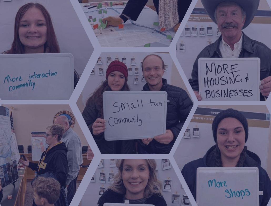
It all started with in-person engagement. It wasn’t always receiving a great return on investment. High effort, low turnout, and unclear input. Poster boards and setup took a lot of work, and few people showed up. Comments left on stickies raised more questions than answers. Who wrote that? What did they mean? And attendees were mostly people with extra time. "We didn't really get a broad, diverse stakeholder group," Gabrielle says.
What changed
The team turned to online tools to be more efficient and to reach more people. With Maptionnaire, they can also be proactive about diverse engagement. Caeley checks mid-project to see who is responding and who is missing, to help focus their outreach. Since adding online engagement, they have seen a higher quality of input and lots of participants.
At Prior Lake Memorial Park, HKGi helped their public client run the engagement process to understand how best to reinvest in the park. Across Prior Lake and Quarry Park, the online engagement drew 290+ participants and 1,400+ website visitors. "We try to lower the barrier to participation as much as possible," Caeley says, and with Maptionnaire, people can take part "on their own time, in their own locations, and on several different devices." Gabrielle says online engagement means "a lower level of effort in setting these up," and HKGi can keep a site open for several weeks so people can respond on their own time.
Getting feedback tied to place
Before Maptionnaire, HKGi's team relied solely on general-purpose online questionnaire tools. Community members could comment on a design, but it was never location-specific — which is what they needed. So HKGi looked for a map-based platform and found Maptionnaire.
Mapping input on 683 acres of winding trails
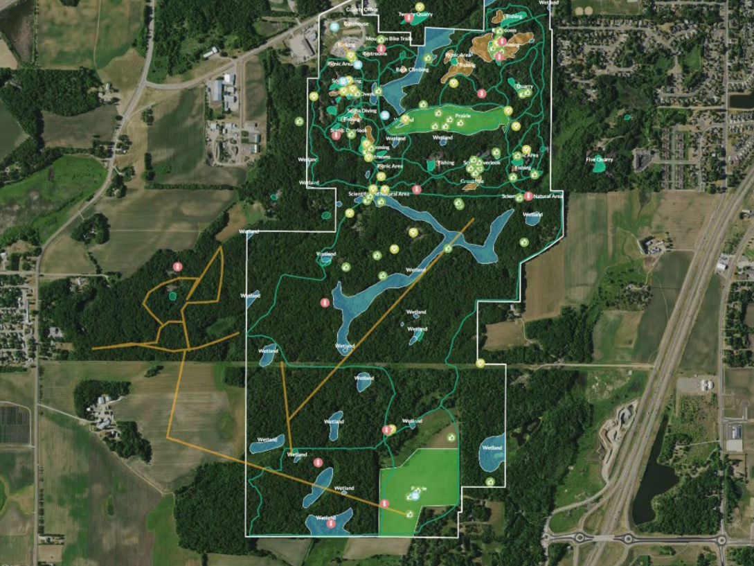
HKGi's master plan for Quarry Park & Nature Preserve (now approved!) relied heavily on interactive mapping. Much of the public interest in the plan had to do with the bike trail network, braided throughout the 683-acre park. As Caeley puts it, "Instead of somebody just simply telling us, 'I don't like this trail,' they can actually show us where the issue is." Gabrielle adds, "The interactive map worked well for drawing lines for those new trails and providing specific feedback on locations within the park."
Mapping feedback on park design alternatives
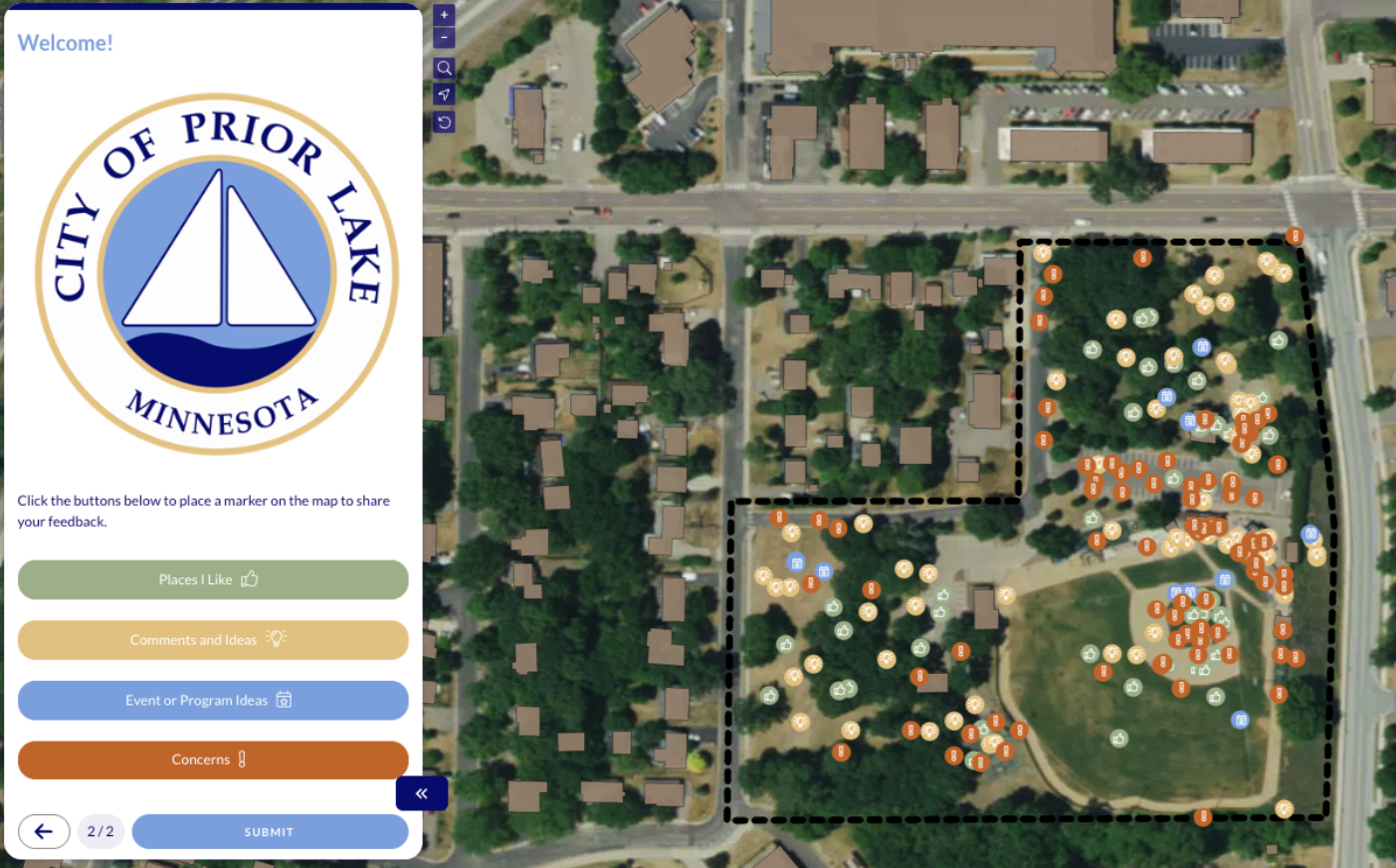
The 11-acre Prior Lake Memorial Park master plan was a very different scale, yet the story is not so different. The first round focused on existing conditions. Their survey combined general preference questions with community mapping, informing their design options.
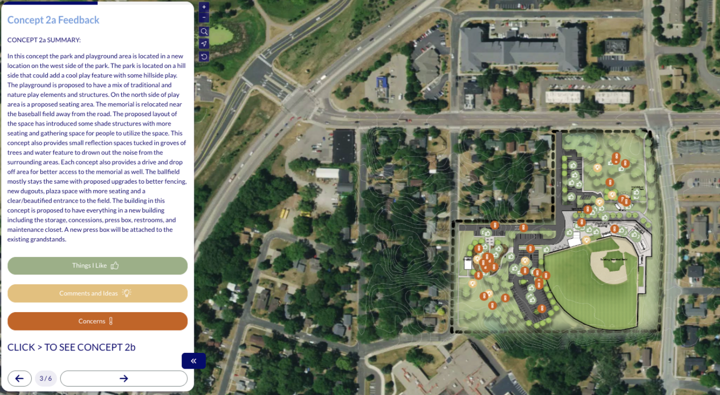
In the second round, community members could see how their round-one comments transformed into design options. Not only could they vote on their favorite design — the map-based survey also got detailed feedback on specific places in the three alternatives.
"Online interactive engagement with mapping has become a lot more central to our engagement practice... Maptionnaire is a key part of that."
Gabrielle Grinde, PLA, Principal Landscape Architect and Vice President at HKGi
Project pages keep people informed
Engagement isn't just surveys. "Really, the highest form of engagement is when we instill a sense of ownership or stewardship in the community members," Gabrielle says. A big part of that is communication.
Throughout these two park projects — and many others — HKGi maintains a dedicated project page. "We just want to make sure they understand what the project is... and why their input matters," says Caeley. The page has clear information about the project, survey results, and how those results are being used in the plans.
One platform instead of four tools
Nowadays HKGi runs the map, the survey, some analysis, and the project website all in one place. Even just having the mapping and non-mapping questions together is already a big convenience for respondents and planners. One link, one survey, and all results in one place. Much easier to analyze: "The summary graphs and charts in Maptionnaire were really helpful to gain quick insight into the findings," Caeley says.
Combined with the landing page, it's nice to have the suite of all of the online methods in one package so that we're not shifting between different online tools
Gabrielle Grinde, PLA, Principal Landscape Architect and Vice President at HKGi
How a typical project runs
The engagement process follows a similar pattern on most projects. In round one, they ask for concerns, assets, and ideas. Round two shows how they used that input in their concepts and asks for feedback. Round three presents the community-preferred plan and checks what was missed. They still show up for community events and open houses, but now with a handy QR code to get that input online after the conversation.
Here are the building-blocks for their online engagement:
- Project page. Introduces the project, explains why input matters, and links to the map and survey. It also carries the schedule, PDFs of boards from events, and summaries of earlier rounds.
- Map. Usually with geolocated site plans or select layers brought in straight from ArcGIS.
- Survey. Non-mapping questions ask people about the "what" and "why". HKGi tries to use structured questions, to avoid processing too many open-ended responses. Tip: Maptionnaire has since launched AI-powered tagging tools for open-ended questions. Learn how it helps analyze thousands of comments.
- Analysis. Maptionnaire's charts show visitors and responses, and HKGi can filter, map, and export the results.
Conclusion: More time to listen, think, plan
So what's this all about? Speed and efficiency? Or meaningful, transparent engagement and community values?
For HKGi, evolving their engagement toolkit and process means their engagement efforts count for more. Less printing posters, less transcribing notes, less compiling and transferring and syncing data. More time to listen, follow through, and design and plan those lovable outdoor spaces.